I’m hoping to use this (relatively new) personal webpage of mine to share interesting things that I’m doing or working on from time to time, so here goes. This entry will be about a relatively short bicycle tour that I took with my girlfriend over a four-day weekend this past August. In part this will be a compendium of what we saw. More than that, though, I hope that I can make bicycle touring more tangible and accessible. I often experience some awe when I describe travel by bicycle and while this is flattering, a bicycle tour is usually not a feat of extreme athleticism. Hardly so! The joy of touring is more accessible than most realize, because the decision of how fast or slow to go rests with you. And while logistics, too, may often seem daunting this need not be so. I’ll try to break that down here as well.
The trip
Where did we go? Why did we go there?
Last year, we took a weeklong trip across New York from Albany to Toronto, in Ontario. That trip was amazing. However, it neither started nor ended in Boston, meaning we had to budget extra time for roundtrip travel. Vacation time was looking a little limited this summer, so we opted for a route that would both begin and end at home.
And so we turned our gaze to Massachusetts, the sixth state to join the Union. Very roughly speaking, Massachusetts has four distinct geographic regions. Here in Boston, we’re along the ocean on a coastal plain. Just west of here, there’s a rather hilly region dividing the ocean and the watershed of the Connecticut River (which itself drains a wide swath of New England). West of that are the Appalachians, in particular the Berkshires and Taconic Ridge, which go right up to the New York State border.
And in the middle, there’s the Quabbin. I’m often surprised that almost no one I meet knows about it. But have you ever noticed the gigantic lake in the middle of Massachusetts? You’ll never un-see it now. The Quabbin Reservoir is the main water supply for the Boston metro area – it’s artificial, filled by a series of dams constructed during the Great Depression. But we’ll get back to that later.
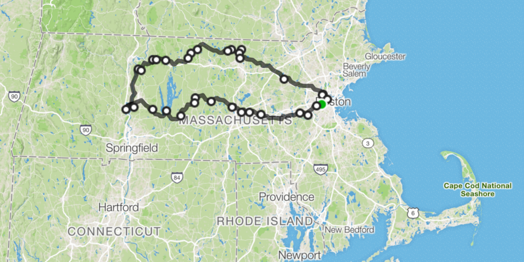
We wanted to see our home state, so we decided to bike from Boston to the Connecticut River Valley (known to locals as the “Pioneer Valley”) and back in three days, circling the Quabbin Reservoir along the way. And while this post is intended to serve as encouragement, I should say that this is not an ideal first bike tour. The route we planned was 230 miles in all, with an aggregated 11,000 feet of elevation gain. But then again, who ever promised that Massachusetts would be flat?
What we brought
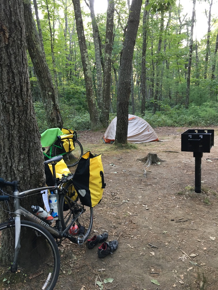
On this particular trip, only one night was spent camping. We brought along a tent, a tent footprint (a tarp) a sleeping bag, sleeping pads, toiletries, and clothes for three days of riding. We also brought a stove (with gas canister and pot) for some campsite cooking. Here’s a photo:
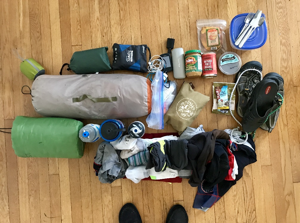
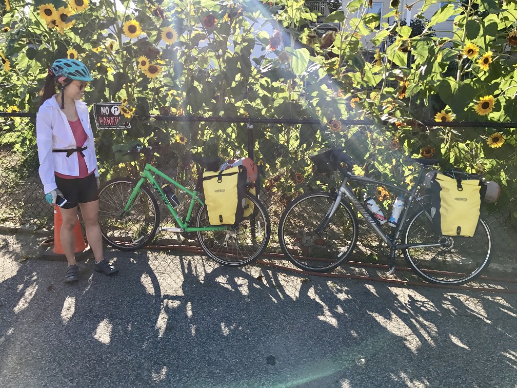
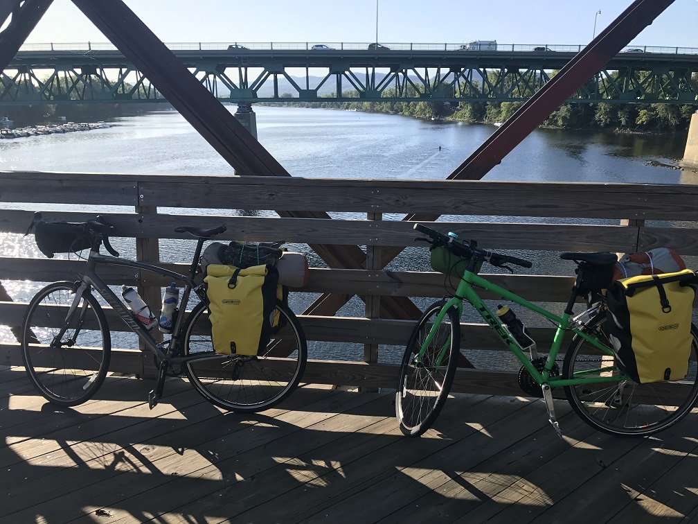
My sleeping pad is larger than I’d like, but everything else is pretty compact. Neither I nor my girlfriend Leticia have special touring bikes, which on first brush you might think are necessary. Definitely not the case! Touring bikes generally have steel or titanium frames which are great for heavy loads, but for a tour brief in duration and scale almost any bike could work (maybe not an incredibly sporty all-carbon road bike, though). I used my Specialized Secteur – a road bike with a relaxed geometry for long rides, 28 mm tires – and Leticia used her Trek hybrid. Both bikes were equipped with rear racks and two panniers for carrying gear. On top of my rack I mounted our tent with bungee cords, and Leticia carried our sleeping bag on hers. We both had handlebar bags as well which provide easy access to things like phones and wallets. See the photo below. This works pretty well – maybe someday if I want a front rack with another set of panniers a new bike would be in order. That would certainly help with carrying a bigger food reserve.
While we’re on that subject, what about food? On a tour this short, this is admittedly not a big issue. In any corner of Massachusetts, grocery stores are in abundance which means that food can be procured daily (even in the middle of the ride). A favorite lunch of ours is a can of refried beans, tomato, and pita, or perhaps pita with peanut butter and banana. But both of those wear on you after a few times. We’re still optimizing.
Day 1 – Boston to Northampton
105 miles
This was an ambitious day – over 100 miles and 5800 feet of climbing. Our route took us out of Boston through Newton and Framingham as we biked underneath I-95 and eventually I-495 (those being, of course, the two interstate highways that serve as ring roads for Boston). In stark contrast to other Northeastern metropolises – Philadelphia and New York are particularly egregious examples – there exist many calm roads for a smooth, relatively low-traffic exit from Boston by bike.
Surprisingly, the area around Worcester proved to be far dicier as far as traffic is concerned. Worcester is New England’s second-largest city (after Boston, which lies 40 miles to the east). It’s criss-crossed by a network of multi-lane highways. That said, the route we took was mostly quiet after the Worcester suburb of Shrewsbury. Unfortunately, this coincided with the onset of a long stretch of climbing. For 15 miles, more or less, we climbed until we reached a summit in the small town of Rutland. Rutland, as it turns out, is the geographic center of Massachusetts and at 52 miles was the midpoint of our ride. We set up our lunch in the town park.
From Rutland we descended into the valley carved out by the Ware River in Central Massachusetts. The Ware flows west, so somewhere near Rutland we crossed the divide between the Atlantic Ocean and the Connecticut River Valley. Having crossed the Continental Divide on my bike before, this is something I try to notice. The river made for easier riding (except when our route took us away from it and into the hills – always pay attention to rivers when planning bike routes).
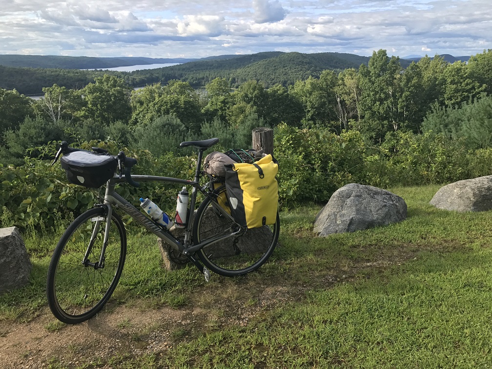
Soon we found ourselves along the south end of the Quabbin Reservoir. This area is maintained as a park by Massachusetts DCR (Dept. of Conservation & Recreation) with a beautiful visitors’ center and walking trails along and near several dams. The main attraction for us was an overlook at the top of a short climb with a panoramic view of the reservoir.
The Quabbin Reservoir was constructed in the 1930s amid increasing demands for water in Boston and the flurry of public works projects throughout the United States accompanying the Great Depression. The Wachusett Aqueduct carries water from the Quabbin to the Wachusett Reservoir where it supplies water to most of the communities in Greater Boston. (As a matter of fact, there’s a fascinating museum about Boston’s water supply that we visited some time ago. Water supplies are a really fascinating topic. I remember really enjoying this article a while back.)
Today, the ‘Lost Towns’ left behind where the Quabbin now stands- there are four of them – form a bit of Massachusetts lore. The lookout surveyed the location of the former town of Enfield. This Enfield Overlook was an interesting perch – to the left, the Connecticut River opened before us with a view of the Berkshires far in the distance. To the right, the rolling hills leading back to the Atlantic were dotted with a few peaks. Looking upon the Quabbin is interesting; due to its winding shape, you can’t see much of it at once.
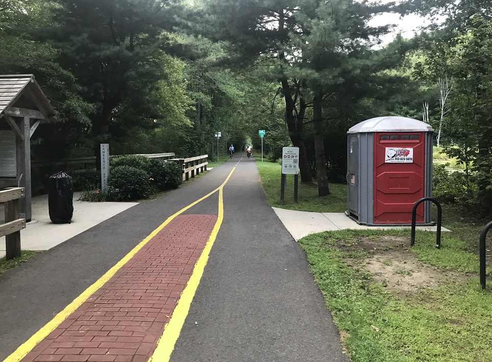
It was all downhill after the overlook, as we whooshed towards the Connecticut through Belchertown. Eventually we came upon the Norwottuck Branch Rail Trail which led us through the college towns of Amherst and Hadley, and before long, across the Connecticut River into Northampton. By that point it was 7:30 PM, and with our century ride completed, we ate a large dinner downtown and settled into a rented room for the night.
Day 2 – Northampton
0 miles
Everyone needs a day off, so we spent this day just walking around Northampton and environs. There’s a lot to see and do. In addition to a few good meals, our favorite activity was a visit to the botanical garden at Smith College, located in Northampton.
Day 3 – Northampton to Pearl Hill State Park
85 miles
The day began with a ride up the Connecticut River Valley. The ride was flat with a slight headwind. This being the end of the summer growing season, we saw truckloads of butternut squash passing by. Eventually, after about 20 miles of riding north, we came upon the town of Montague. After a quick stop at a used bookshop in a former mill, we turned east to ride back toward Boston and started climbing for the day. Montague is near the point where the west-flowing Millers River drains into the Connecticut. It reminded me a bit of biking in West Virginia because the river is bounded by steep hills. This meant there weren’t many roads available to choose, and we ended up on Route 2 (the old Albany-Boston Post Road, a major highway) for longer than we would have liked.
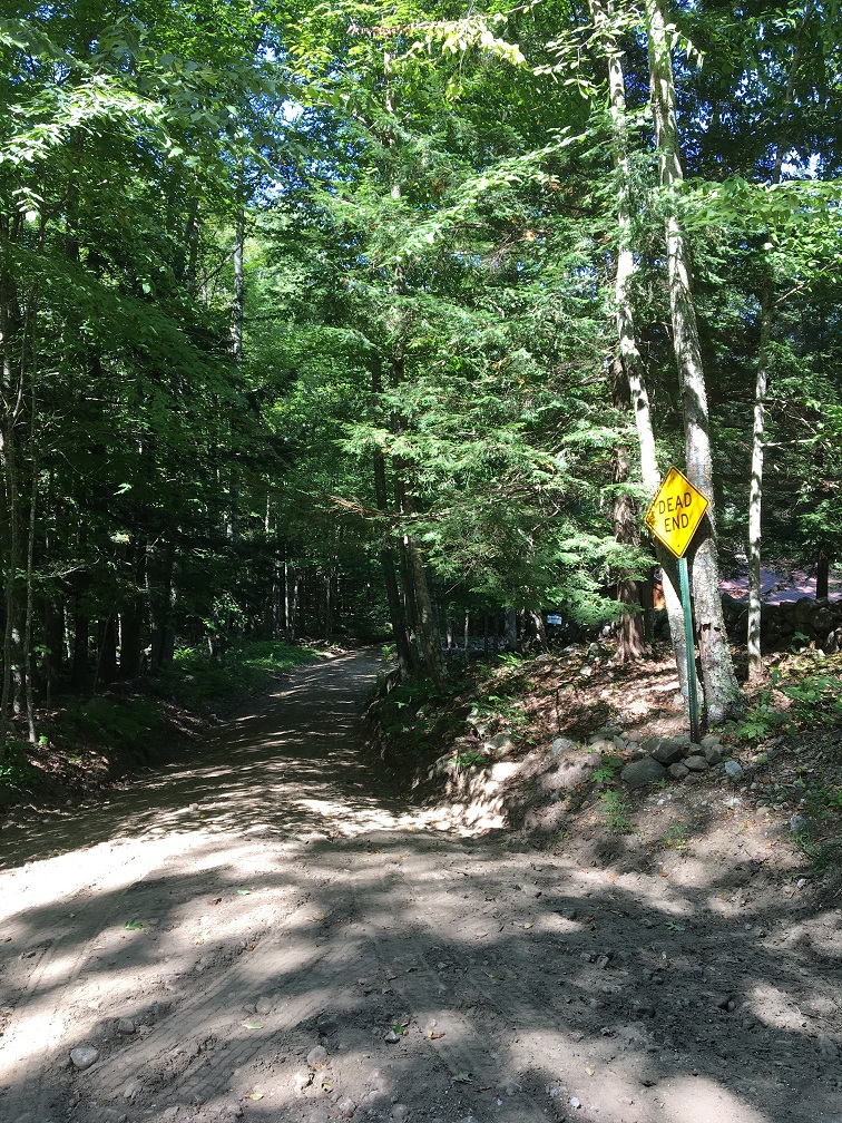
We soon reached Athol, a city that is built on a hillside. There were some very steep (and thankfully brief) roads in town. After lunch along the Millers River in Orange, we turned onto a small road that was supposed to take us to Royalston, a small town near the New Hampshire state line. Instead, we found this:
A road that existed on Google Maps ceased to exist in reality! I reported the issue, which hopefully they have fixed…
This was the beginning of a long, painful slog along Route 2 through Templeton, Gardener, and Fitchburg. I realize now that this section was ever-so-slightly uphill, slight enough to escape my direct notice. Instead we were left with a bothersome feeling of being terribly out-of-shape. A bright spot presented itself in the form of an apple orchard and a delicious frozen apple cider slushie.
Eventually, as the sun was setting, we rolled into Pearl Hill State Park, a hidden gem just five miles north of Fitchburg. It was a Monday night, and we were among only five parties staying at the campground. We set up our tent, failed to start a campfire, and prepared a quick meal of barley over our stove (Leticia forgot our beans!).
Day 4 – Pearl Hill State Park to Cambridge
52 miles
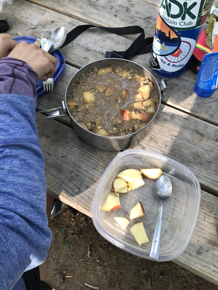
We woke up, packed, and cooked a delicious breakfast of apples, oatmeal, and peanut butter over the stove. And – like our meal – this last day was a real treat. Gravity eased our way towards the Atlantic Ocean from the hills near Fitchburg, a relief after crossing traversing the hills of Central Massachusetts in both directions. We zoomed through Ayer, Littleton, Concord, and eventually Bedford. From there, we got on the Minuteman Commuter Rail Trail for the 11 mile ride toward Alewife and home. We even made it back before lunch!
Update:
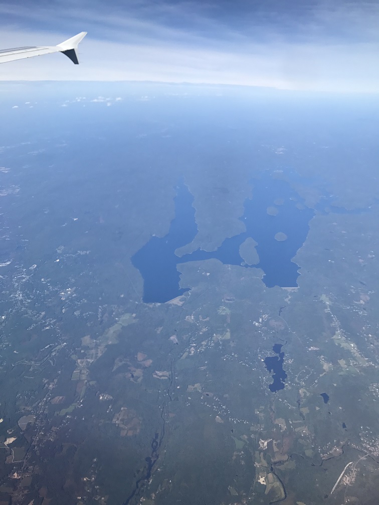
A few weeks later I found myself on a westbound flight from Boston. I got to retrace our first-day, 104 mile bike ride in about 10 minutes and from a much higher vantage point. From up there, I could see the whole Quabbin Reservoir, including the overlook and visitors’ center at the south end.